Appraisal procedure
Task definition
Overview plan with processing limits
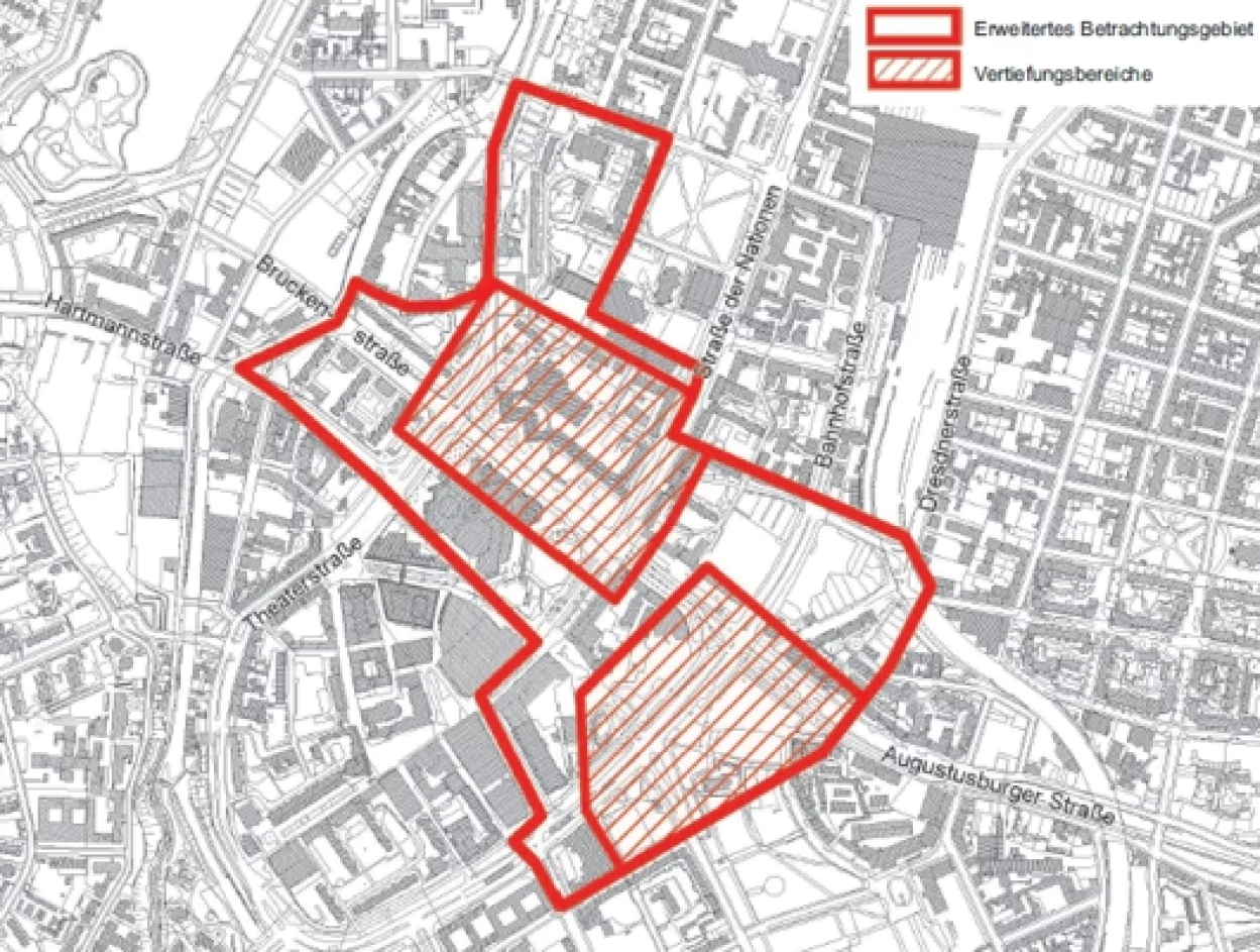
The area covered by the appraisal process includes the Bahnhofstraße and Brückenstraße areas, which are important for the further development of Chemnitz city centre. It is divided into an extended area under consideration and two in-depth areas.
Many of the building plots earmarked for development in the 2005 city centre framework plan are located in the area under consideration. These are the construction sites F4 (Bahnhofstraße/Johannisplatz), E3 (Bahnhofstraße/Zschopauer Straße), J1 (Dresdner Straße/Bahnhofstraße) and J2 (Bahnhofstraße/Waisenstraße).
In addition, there are two other sites in the area that are large and therefore also important for the further development of the city centre: construction site E4 and construction site J5.
Task definition
Chemnitz city council is planning to update the city centre framework plan. Among other things, the framework plan is intended to clearly present the municipality's development intentions to citizens and investors and create planning certainty. The area under consideration in the appraisal process is an important part of the framework plan update, as it contains key construction sites for the further development of Chemnitz city centre.
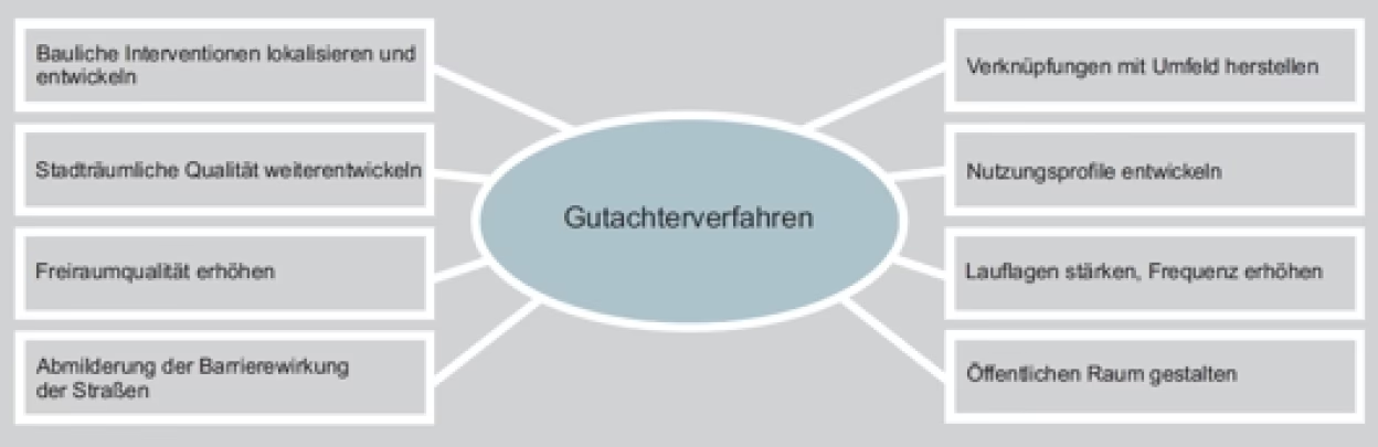
As part of the appraisal process, proposed solutions were to be developed that provide answers to the following questions:
- How can the urban quality of the city centre be further developed, especially with regard to its periphery (centre ring with surrounding area)? What measures are necessary to convey a positive image of the city centre to potential investors and visitors in terms of city marketing?
- How should the network of open spaces between the Park of the Victims of Fascism, the Chemnitz River and the Schlossteich be rethought in connection with the necessary structural rounding off of the city centre and taking into account the rainwater overflow basin to be integrated on Brückenstraße?
- Where are structural interventions required with which utilisation profile and which structural configuration?
- What scope is there for designing the streetscape of the city centre ring road in terms of urban integration, crossability and mitigation of the barrier effect with a view to a possible noticeable reduction in the volume of motor vehicle traffic in the time horizon up to 2040? And which elements of this can already be designed and implemented in the 2025 perspective?
- What measures can be taken to overcome the barrier effect of Brückenstraße and the Brückenstraße 10 - 12 building complex? What design proposals can be derived from this for Brückenstraße, integrating the urban railway line and taking into account the wide side spaces? How can the quality of the urban space and open spaces around the Karl Marx Monument be improved while respecting the listed status of the ensemble?
- What urban development and urban design measures can be used to strengthen the (retail) pedestrian areas and achieve the necessary pedestrian frequencies? This should be analysed above all for the complex of building plots F4, E3 and E4 on Bahnhofstraße and building plot J5 on Straße der Nationen/ Brückenstraße.
- How must the public space be designed to successfully link the city centre with the neighbouring urban districts? What does this mean in particular for the design of the city centre ring road with a special focus on the crossability and urban integration of Bahnhofstrasse and Brückenstrasse while at the same time safeguarding their traffic function?
- How can the functional link between the narrower city centre and Park Am RotenTurm with the Brühl and Theaterplatz areas be resolved?